FR
![]()
|  |
SGIB des Troufferies de Libin et ses abords
Localisation du site
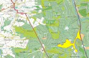
Localisation du SGIB 65 - Troufferies de Libin |
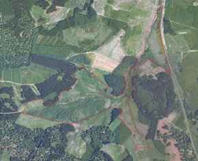
Vue aérienne du SGIB en début de projet (orthophoto de 2007). |
Informations descriptives et biologiques
Voir la fiche SGIB 65
Vues aériennes
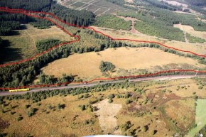
Septembre 2010 - le "croissant" à l'est de la RND avant les travaux |
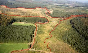
Septembre 2010 - Vue de la RND des Troufferies de Libin, centrée sur le Ruisseau de la Noire Eau. |
Actualité illustrée du site
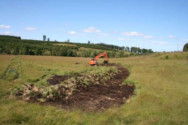
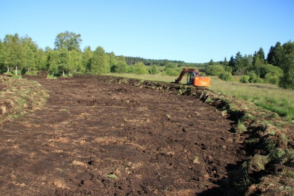
Automne 2012 - Etrépage d'une troisième zone, au lieu-dit Contranhez (enclave entre le Serpont et le chemin de fer). Cette zone présente la particularité de ne plus pouvoir bénéficier des apports hydriques du bassin versant. En effet l'infrastructure du chemin de fer située en amont de la zone étrépée dévie l'eau de ruisselllement vers la rivière. La seule source d'eau pour l'ennoiement des zones étrépées et donc d'origine pluviale. |
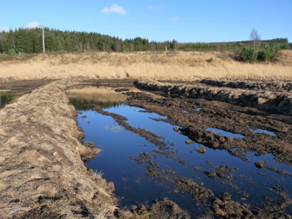
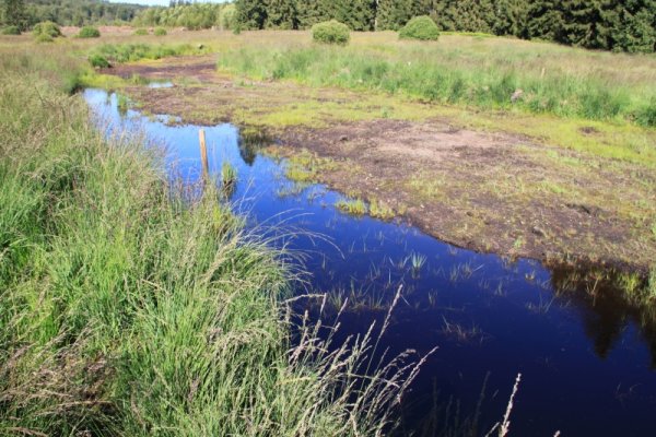
Automne 2012 - Une petite zone étrépée au printemps 2012 présente déjà un intéressant panel d'espèces végétales. |
Août 2012 - Etrépage d'une lande humides dégradée par la Molinie (Molinia caerulea). |
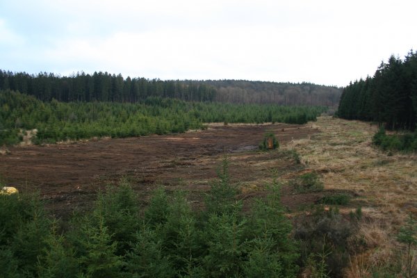
Décembre 2011 - Chantier de gyrobroyage de résineux en cours le long de la Noire Eau (rive gauche - propriété communale de Libin). Les semis naturels d'épicéas occupaient tout le lit majeur de ce petit ruisseau. La rive droite est la propriété de la commune de Libramont-Chevigny, qui a également décidé de restaurer l'intérêt écologique du site en dégageant les épicéas sur une bande de 30m à compter de la berge. |
Avril 2011 - La réserve naturelle est dotée d'un patrimoine historique et culturel tout particulier : les tertres d'orpaillage. Il s'agit de petit monticules, en bordure de rivière, datant de la période celtique. L'or était recherché dans les alluvions de la rivière. Lorsque les paillettes d'or étaient extraites, on entassait les alluvions examinés sur le bord de la rivière. D'un point de vue biologique, les tertres présentent l'intérêt de créer du micro-relief dans le paysage et donc des conditions climatiques particulières. Plusieurs espèces aiment venir se réchauffer sur la pente sud du monticule. Les tertres étaient en voie de recolonisation par les bouleaux. Un petit tronçon de la rivière a donc été dégagé des bouleaux pour remettre en lumière les tertres. |
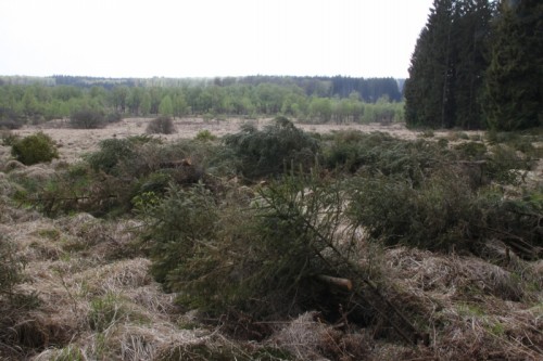
Avril 2011 - L'entièreté de la réserve naturelle est parcourue, débroussailleuse et tronçonneuse à la main. Tous les semis naturels d'épicéa sont systématiquement coupés. Le Département Nature et Forêt, chargé de la gestion de la réserve, veillait depuis plusieurs années à limiter l'expension des jeunes épicéas. Leur densité était donc faible mais un passage récurrent reste nécessaire vu la proximité des peuplements d'épicéas voisins, se propageant aisément vers la réserve. |
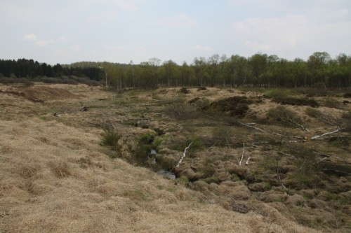
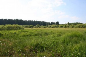
Juin 2010 - Vue du versant sud de la RND avant travaux |
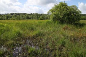
Juillet 2010 - Vue du versant sud de la RND avant travaux |
EN
![]()
|  |
SGIB of theTroufferies de Libin and bordering areaas
Location of the site
Location of the SGIB 65 - Troufferies de Libin |
Aerial view of the SGIB at the beginning of the project (orthophoto from 2007) . |
Descriptive and biological information
See file SGIB 65
Aerial views
September 2010 - the "billhook" in the east Troufferies before the works |
September 2010 – View from the RND centred on the Ruisseau of the Noire Eau |
Current situation of the site
Autumn 2012 – Turf stripping of a third zone, in a place known as Contranhez (enclave between le Serpont and the railway). The particular feature of this area is that it is no longer able to benefit from the water intake from the water catchment. In fact the railway infrastructure situated upstream of the turf stripped area diverts the run-off water towards the river. The only water source for the artificial flooding of the turf stripped areas and therefore resulting from rainfall. |
Autumn 2012 – A small area stripped of turf in spring 2012 is already showing an interesting range of plant species. |
August 2012 – Turf stripping of an area of wetland that has been degraded by Molinia (Molinia caerulea) |
December 2011 – Resinous tree rotary slashing site is operational along the Noire Eau (left bank – municipal property of Libin). The volunteer spruces occupy the whole of the river basin of this small brook. The right bank belongs to the municipality of Libramont- Chevigny, which has also made the decision to restore the ecological interest of the site by clearing spruces over a strip of 30m starting at the riverbank. |
April 2011 – The nature reserve has a very special historical and cultural heritage: the gold-prospecting buttes. These are small mounds found on river banks which date back to the Celtic period. The gold was found in the river deposits. When the gold specks were removed, the sediment that had been inspected was piled up next to the river. From a biological point of view, the buttes are interesting in that they create micro-relief in the landscape and therefore create particular climatic conditions. A range of species delight in warming themselves up on the southern slope of the knoll. The buttes were being recolonised by birches. A small section of the river has therefore been cleared of birches to try to bring light to the buttes. |
April 2011 – The whole of the nature reserve is explored, cleared and logged by hand. All of the natural regeneration spruces are systematically felled. The Department for Nature and Forests, overseeing the management of the reserve, has been limiting the expansion of the young spruces for several years. Their density was therefore weak but it is still necessary to visit the site repeatedly given the proximity of neighbouring spruce populations, which spread easily towards the reserve. |
June 2010 - View from the Southern slope of the RND before the works |
July 2010 - View from the Southern slope of the RND before the works |


 Zoom sur la carte