


![]()
|  |

A1. Collecting, completing and reformulating the general indormation needed for the project
The first stage of preparation is to use a geographical system to collect all of the information required for the project. This means having several different layers of information available regarding:
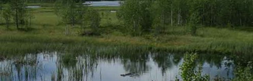
- current land use (environment, vegetation, biotopes) and setting out of the biological challenges,
- the area's hosting potential for habitats which are of interest to the community and which are the focus of the project but also in conjunction with forestry production, taking into account the various types of soils (pedology, drainage, depth, granulometry), relief (digital model), orientation, and so on, to refine the definition of stations locally,
- the cadastral survey to identify unambiguously the relevant land owners and managers,
- the chronicle of works, revenues and investments recently undertaken in these areas in order to assess, in the light of expected productivity, situations at local level (drain maintenance difficulties, thinning and cutting, risk of windthrow, etc.) and the expected economic potential of the areas concerned.
These different aspects will allow the priority areas to be identified in the area where the work is being undertaken and will pave the way for discussions about future management options with owners
A2. Detailed cartography of sites and restoration plan
Once the owners have become involved and the exact plots that are going to be restored have been identified, implementing the restoration works will involve:
- a highly precise mapping exercise of the vegetation, ground relief and water drainage on the site and areas bordering it,
- a very precise definition of the works to be carried out (cutting of spruces, removal of residues and/or use of them to block up drains, filling in of drains, excavation of depressions, construction of dams made from minerals or sheet piling, etc.).
This information will allow restoration plans to be defined for each zone, complete with their respective objectives, the activities involved and a timeline for the works. They will also serve to document what has been achieved over the course of the project.
The LIFE team has drafted restoration plans for the four RND (National Nature Reserves) situated along the working perimeter (Troufferies de Libin, fange de Tailsus, Haie à Chenot and Pré des Forges). The surface area covers 97 ha in total. These restoration plans have been submitted for the opinion and approval of owners, managers (DNF – Department for Nature and Forests), the Commission Consultative de Gestion des RND de Neufchâteau (Neufchâteau Advisory Committee for RND Management), scientific experts from DEMNA (Natural and Agricultural Environmental Studies Department) and local naturalists.
Aside from the four RNDs, the LIFE team is making daily progress on the restoration plans; the spruce-cutting plans are often the first step. Once the spruces have been cut, the aquatic restoration opportunities/needs become much more apparent. The mapping of restoration projects is used directly in the call for contractors through tenders for the works.